These images are all about 200 k each, so view the thumbnails then download what you want. There were other activities that did not get photographed (sorry)
7 and 8 September: initial glacier safety training and orientation on the glacier
9 September: student presentations, test ice coring and work around the climate station
10 September: ice front and moraines
11 September: firn coring and pit work in the northern niche
12 September: DEP profiling of firn core and thin section work in the cold lab.
13 September: walking out of the Tarfala
Valley.
Javad base station location from true fixed
point location
Jim' s stakes survey
Regine's climate station kinematic slope
survey
Isfallglacier stakes
Glacier front survey points
Glacier front trajectory 1
Glacier front trajectory 2
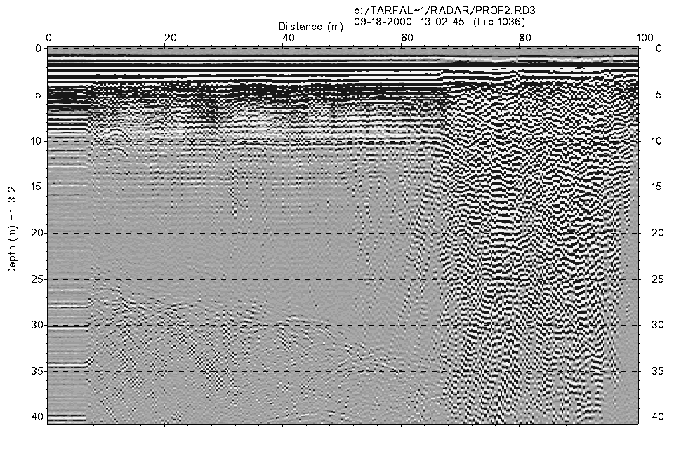
This is an image of the data collected with Ramac
200 MHz unshielded antennas along the margin of the glacier.
The base of the glacier can be seen dipping from 25 to 35 m depth
across the image. The large back scattering from
65 m to 100 m is due to crossing a very wet saturated snow cover region
of the glacier.Back to home page